Scioto County Storm Chaser Center

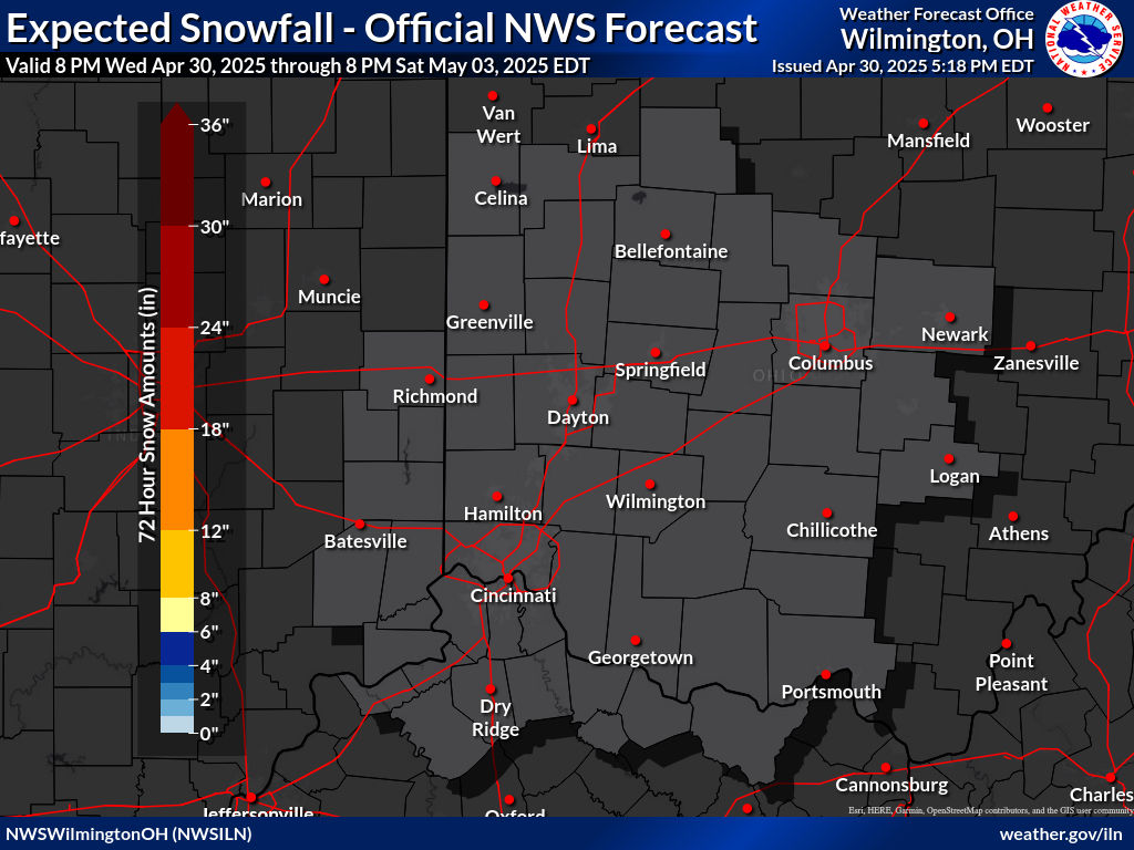
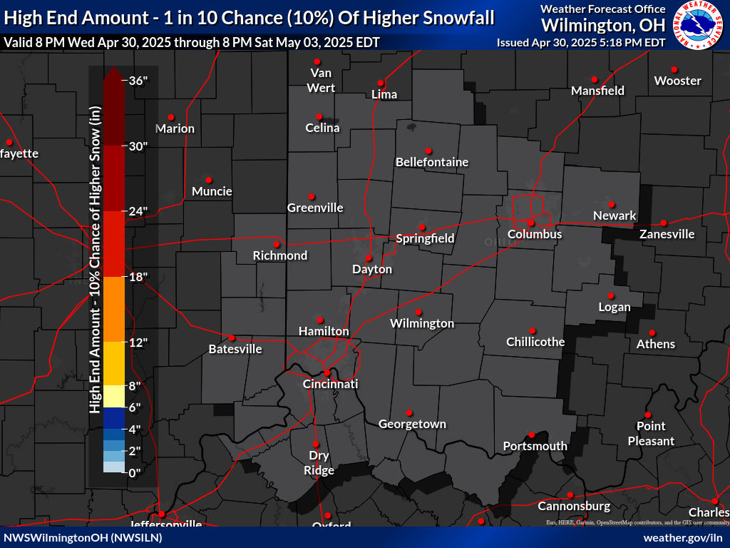
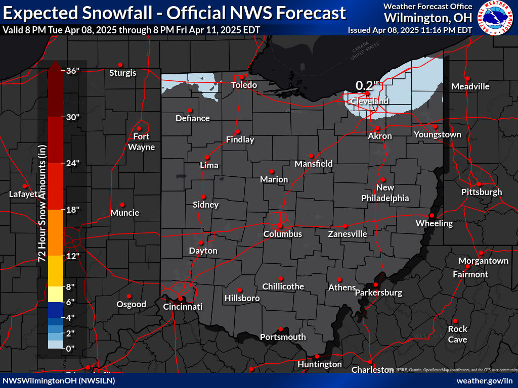
Scioto County Storm Chaser Center is a Non-Profit Organization that was established on August 22, 2005. This organization was formed to provide weather information to the public in Scioto County, Ohio, and surrounding counties. The surrounding counties are Adams, Jackson, Lawrence, and Pike in Ohio, and Carter, Greenup, and Lewis in Kentucky. To provide the community with the best weather information from the National Weather Service in Wilmington, Ohio, and Charleston, West Virginia.

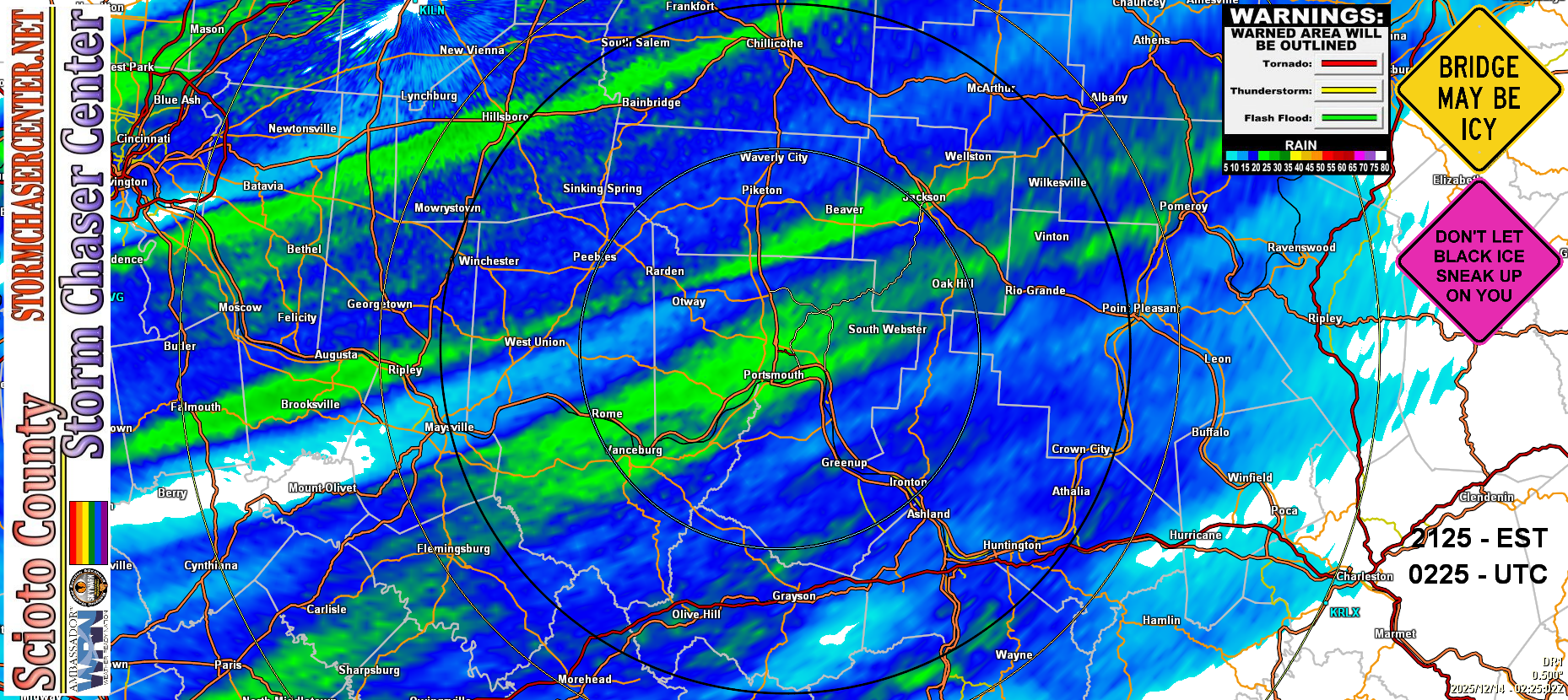
Providing the following weather information: Forecast from the National Weather Service, Local and surrounding Radars, Watches/Warnings and Advisories, Children's Safety Guides, Owlie's Safety Guides for Children, Adult Safety Guides, Weather Guides, SkyWARN Training Schedule for Wilmington, Ohio and Charleston, West Virginia. Also provide Links for School Delays & Closings from the WSAZ News Channel 3, WBNS News Channel 10, WKRC News Channel 12, WKTY News Channel 27, and WOWK News Channel 13. Links to Online Radio Stations, and Links for Weather Cams from the Ohio Department of Transportation. And Links to Weather Apps for your Mobile Devices. In addition, Sponsors & Partners Page of Sponsors & Partners of the Scioto County Storm Chaser Center, and Testimonials by our Viewers.

You can Follow the Scioto County Storm Chaser Center on Facebook. Posts for Advisories, Watches, and Warning, and Radar Images during Severe Storms. In addition, we also post Weekly Forecast from the National Weather Service Office in Wilmington, Ohio. You can Follow Us there by going to www.facebook.com/SCSCC45662OH and Click on "Like".

Facebook Users: Please use #OHWX to report Storms in Ohio and use #KYWX to report Storms in Kentucky.

Scioto County Storm Chaser Center became a Weather-Ready Nation Ambassador with the NOAA/NWS on January 13th, 2018.

Weather-Ready Nation Ambassador Certificate

SCSCC Radar BR
CLICK HERE TO VIEW PURPLRAIR LOCAL AIR QUALIY SENORS
Warning Sirens Chart

Tornado Risk Map

WSAZ - 7 Day Forecast, Huntington, WV - WSAZ Weather
WSAZ 7 Day Forecast
WKRC - 7 Day Forecast, Cincinnati, OH - WKRC Weather
WKRC 7 Day Forecast
WKYT - 7 Day Planner, Lexington, KY - WKYT Weather
WKYT 7 Day Forecast
NWS Wind Chill Index Chart
NWS Heat Index Chart
NWS Heat Disorders
NWS Dew Point Comfort Range
The Beaufort Wind Scale

Force Name

 Wind Speed knots       mph

Consequence
0 Calm 0 0 Smoke rises vertically

Wave height: 0 m - Sea: Like a mirror

1 Light Air 1-3 1-3 Smoke drifts with air

Wave height: 0.1 m (.25 ft) - Sea: Ripples - No foam crests

2 Light Breeze 4-6 4-7 Weather vanes become active

Wave height: 0.2-0.3 m (0.5-1 ft) - Sea: Small wavelets - Not breaking

3 Gentle Breeze 7-10 8-12 Leaves and small twigs move

Wave height: 0.6-1 m (2-3 ft) - Sea: Small wavelets - Crests begin to break

4 Moderate Breeze 11-16 13-18 Small branches sway

Wave height: 1-1.5 m - Sea: Small waves becoming longer, numerous whitecaps.

5 Fresh Breeze 17-21 19-24 Small trees sway - Waves break

Wave height: 2-2.5 m (6-8 ft) - Sea: Moderate waves - Many whitecaps

6 Strong Breeze 22-27 25-31 Large branches sway

Wave height: 3-4 m (9.5-13 ft) - Sea: Larger waves forming - Whitecaps everywhere

7 Near Gale 28-33 32-38 Whole trees sway - difficult to walk

Wave height: 4-5.5 m (13.5-19 ft) - Sea: Sea heaps up - White foam blown around

8 Gale 34-40 39-46 Twigs break off trees

Wave height: 5.5-7.5 m (18-25 ft) - Sea: Edges of crests break into spindrifts

9 Strong Gale 41-47 47-54 Shingles blow off roofs

Wave height: 7-10 m (23-32 ft) - Sea: High waves - Sea rolls - Reduced visibility

10 Storm 48-55 55-63 Trees uprooted - Damage to buildings

Wave height: 9-12.5 m (29-41 ft) - Sea: Very high waves with overhanging crests

11 Violent Storm 56-63 64-73 Widespread damage

Wave height: 11.5-16 m (37-52 ft) - Sea: Exceptionally high waves

12 Hurricane Over 63 Over 73 Violent destruction

Wave height: 16+ m (52+ ft) - Sea: Sea completely white - Excessive foam