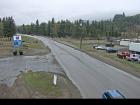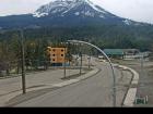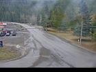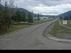
Welcome to the BC HighwayCams website, where you can view highway conditions, traffic, and weather information at a glance.
To view BC HighwayCams, select one of the tabs below and click on a thumbnail. (NR-Northern Region; SIR-Southern Interior Region; LM-Lower Mainland; VI-Vancouver Island; Brdr-Border; All-All webcams; MyCams-Customize your own page of images.)
Please note all BC HwyCams use Pacific Time Zone (PT).
Attention motorists:
Fall weather can make highway conditions in B.C. unpredictable, particularly through high mountain passes. Winter tires or chains are required on most routes in British Columbia from October 1 to April 30.

Click for more information
 | NR |  |  | SIR |  |  | LM |  |  | VI |  |  | Brdr |  |  | All |  |  | MyCams |  |
| |||||||
Highway 1 (Trans Canada Highway) | |||||||
 Boston Bar - N Highway 1 about 12 km north of Boston Bar at Kahmoose Road in Boothroyd, looking north. | 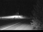 Boston Bar - S Highway 1 about 12 km north of Boston Bar at Kahmoose Road in Boothroyd, looking south. | ||||||
New!
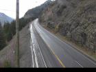 Jackass Mountain - N Highway 1 between Boston Bar and Lytton at Jackass Mountain summit, looking north. |
New!
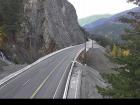 Jackass Mountain - S Highway 1 between Boston Bar and Lytton at Jackass Mountain summit, looking south. | ||||||
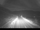 Spences Bridge Highway 1 at the north end of Spences Bridge on the west side of the Thompson River, looking north. | |||||||
 Sorrento - Blind Bay Highway 1 at Highland Drive east of Sorrento at the Blind Bay turn off, looking southeast. | |||||||
 Rogers Pass Highway 1 about 72 km east of Revelstoke at Rogers Pass in Glacier National Park, looking east. | |||||||
Highway 0 (Adams Lake) | 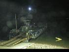 Adams Lake West Ferry Landing Adams Lake Ferry west shore landing, looking at ferry landing on west side of lake. | 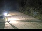 Adams Lake West Ferry Lineup Adams Lake Ferry west shore landing, looking at ferry line up toward Rawson Road. |  Adams Lake East Ferry Landing Adams Lake Ferry east shore landing, looking at ferry landing on east side. | ||||
Highway 3 |  Allison Pass - W Highway 3 about 10 km west of Manning Park resort area at Allison Pass, looking west. | ||||||
 Eholt Summit Highway 3 about 16 km northeast of Greenwood at Wilgress Rest Area near Eholt Summit, looking westbound. | |||||||
 Sparwood Highway 3 about 2 km west of the Alberta border at Sparwood Weigh Scale, looking southeast. | |||||||
Highway 3A |  Glade Ferry Terminal - W Highway 3A at Glade Ferry Road, looking at ferry landing on west side of river. |  Glade Ferry Terminal - E Highway 3A at Glade Ferry Road, looking at ferry landing on east side of river. | |||||
 Harrop Ferry Landing North View Harrop Ferry Landing on south side of Kootenay Lake, looking at the north side landing. |  Balfour Ferry Approach - NE Highway 3A and Highway 31 at Balfour ferry terminal entrance near Ferry Landing Road, looking northeast. |  Balfour Ferry Busk Road Parking Highway 3A and Highway 31 at Busk Road near the Balfour ferry terminal, looking at ferry parking lot. | |||||
 Balfour Ferry Approach - SW Highway 3A and Highway 31 at Balfour ferry terminal entrance of Ferry Landing Road, looking southwest. | |||||||
Highway 3A (Kaleden to Keremeos) | |||||||
Highway 3B |  Rossland southound Highway 3B at Highway 22 near the Rossland Weigh Scale, southbound on Highway 22. |  Rossland northbound Highway 3B at Highway 22 near the Rossland Weigh Scale, northbound on Highway 3B. | |||||
Highway 5 (Coquihalla) |  Hwy 5 at Hwy 97D northbound Highway 5 at Exit 366 Logan Lake/Lac le Jeune Road, looking northbound along Highway 5. | ||||||
 Hwy 5 at Hwy 97D southbound Highway 5 at Exit 366 Logan Lake/Lac le Jeune Road, looking southbound along Highway 5. | |||||||
 Zopkios Southbound - N Highway 5 southbound at Zopkios Rest Area near the Coquihalla Summit, looking north. |  Zopkios Southbound - S Highway 5 southbound at Zopkios Rest Area near the Coquihalla Summit, looking south. | 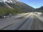 Zopkios Northbound - N Highway 5 northbound at Zopkios Rest Area near the Coquihalla Summit looking north. | 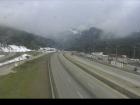 Zopkios Northbound - S Highway 5 northbound at Zopkios Rest Area near the Coquihalla Summit looking south. | ||||
Highway 5 | |||||||
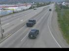 Halston Avenue / Paul Lake Road - N Highway 5 at Halston Avenue / Paul Lake Road in Kamloops, looking north. | 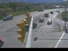 Halston Avenue / Paul Lake Road - W Highway 5 at Halston Avenue / Paul Lake Road in Kamloops, looking west. | 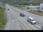 Halston Avenue / Paul Lake Road - E Highway 5 at Halston Avenue / Paul Lake Road in Kamloops, looking east to Paul Lake Road. |  Halston Avenue / Paul Lake Road - S Highway 5 at Halston Avenue / Paul Lake Road in Kamloops, looking south. | ||||
Highway 6 | 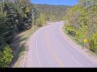 Needles Ferry Bend End Highway 6 at Needles Ferry Landing, looking west away from ferry landing towards Needles Road N. | ||||||
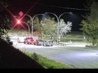 Needles Ferry Rest Area Highway 6 at Needles Ferry Landing, looking east towards front of line up near the rest area. | |||||||
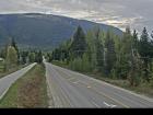 Burton Main Road Highway 6 in Burton at Burton Main Road, about 22 km north of Fauquier, looking south. | 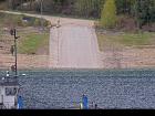 Arrow Park Ferry North Terminal Highway 6 at South Arrow Park Ferry Terminal, 22 km south of Nakusp at junction of Upper and Lower Arrow Lakes, looking at north landing. | 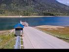 Arrow Park Ferry South Terminal - N Highway 6 at South Arrow Park Ferry Terminal, 22 km south of Nakusp at junction of Upper and Lower Arrow Lakes, looking north. | 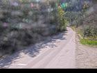 Arrow Park Ferry South Terminal - S Highway 6 at South Arrow Park Ferry Terminal, 22 km south of Nakusp at junction of Upper and Lower Arrow Lakes, looking south on Arrow Park Road. | ||||
Highway 20 |  Heckman Summit Highway 20 about 88 km from Bella Coola and 41 km from Anahim Lake, near gate at top of Bella Coola hill, looking west. | ||||||
Highway 23 | 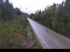 Blanket Creek - N Highway 23 about 30 km south of Revelstoke and 22 km north of Shelter Bay Ferry, looking north. |  Blanket Creek - S Highway 23 about 30 km south of Revelstoke and 22 km north of Shelter Bay Ferry, looking south. | |||||
 Shelter Bay - Middle Highway 23 near the Upper Arrow Lake ferry landing at Shelter Bay, middle of queue, looking north. |  Shelter Bay - Front Highway 23 near the Upper Arrow Lake ferry landing at Shelter Bay, front of queue, looking north. |  Galena Bay Landing - Front Highway 23, near the Upper Arrow Lake ferry landing at Galena Bay, looking at front of lineup. |  Galena Bay Landing - Middle Highway 23 near the Upper Arrow Lake ferry landing at Galena Bay, looking at middle of lineup. | ||||
 Galena Bay Landing - End Highway 23 near the Upper Arrow Lake ferry landing at Galena Bay, looking at end of lineup. | |||||||
Highway 24 | |||||||
Highway 26 | |||||||
Highway 31 | |||||||
Highway 31A | |||||||
Highway 33 |  McCulloch - N Highway 33 about 41 km southeast of Kelowna, just south of Big White Road, looking north. |
New!
 McCulloch - S Highway 33 about 41 km southeast of Kelowna, just south of Big White Road, looking south. | |||||
Highway 43 | |||||||
 Line Creek Mine Road Highway 43 between Sparwood and Elkford at Line Creek Mine Road, looking north. | |||||||
Highway 93 |  Radium Hot Springs northbound Highway 93/95 roundabout at Radium Hot Springs, looking northbound on Highway 95. |  Radium Hot Springs eastbound Highway 93/95 roundabout at Radium Hot Springs, looking eastbound on Highway 93. |  Radium Hot Springs southbound Highway 93/95 roundabout at Radium Hot Springs, looking southbound on Highway 93/95. | ||||
Highway 0 (Toby Creek Road) | |||||||
Highway 95 | |||||||
Highway 95A | |||||||
Highway 97 (Southern Interior Region) | |||||||
 McLeese Lake - SE Highway 97 and Beaver Lake Road junction north of McLeese Lake, looking southeast. |  Bull Mountain - N Highway 97 north of Williams Lake near the turn off to the Bull Mountain ski area, looking north. |  Bull Mountain - S Highway 97 north of Williams Lake near the turn off to the Bull Mountain ski area, looking south, | |||||
 Begbie Summit Highway 97 at Lookout Road near Begbie Summit about 21 km south of 100 Mile House, looking north. | |||||||
 WR Bennett Bridge 11 WR Bennett Bridge east approach at Abbott Street, looking west along Highway 97. |  Hwy 97 at Hwy 97C - N Highway 97 at Highway 97C junction about 5 km south of Westbank, looking north. | ||||||
 Hwy 97 at Hwy 97C - W Highway 97 at Highway 97C junction about 5 km south of Westbank, looking west. |  Hwy 97 at Hwy 97C - E Highway 97 at Highway 97C junction about 5 km south of Westbank, looking east. | 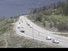 Hwy 97 at Hwy 97C - S Highway 97 at Highway 97C junction about 5 km south of Westbank, looking south. | 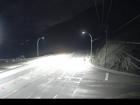 Callan Road Highway 97 at Callan Road, about 6 km north of Summerland and 15 km south of Peachland, looking south. | ||||
Highway 97A | |||||||
Highway 97C |  Highland Valley Road - N Highway 97C at Highland Valley Road between Merritt and Ashcroft, looking north. |
New!
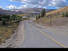 Highland Valley Road - W Highway 97C at Highland Valley Road between Merritt and Ashcroft, looking west. |
New!
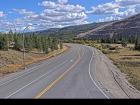 Highland Valley Road - S Highway 97C at Highland Valley Road between Merritt and Ashcroft, looking south. |  Aspen Grove - N Highway 97C (Okanagan Connector) at Highway 5A junction near Aspen Grove, looking north. | |||
 Aspen Grove - S Highway 97C (Okanagan Connector) at Highway 5A junction near Aspen Grove, looking south. |  Pothole Lake - W Highway 97C (Okanagan Connector) about 7 km east of Aspen Grove near Pothole Lake, looking west. |  Pothole Lake - E Highway 97C (Okanagan Connector) about 7 km east of Aspen Grove near Pothole Lake, looking east. |  Elkhart - W Highway 97C (Okanagan Connector) about 25 km east of Highway 5A and Highway 97C junction, looking west. | ||||
 Elkhart - E Highway 97C (Okanagan Connector) about 25 km east of Highway 5A and Highway 97C junction, looking east. |  Brenda Mine - W Highway 97C (Okanagan Connector), about 22 km west of Highway 97 and Highway 97C junction, looking west. |  Brenda Mine - E Highway 97C (Okanagan Connector) about 22 km west of Highway 97 and Highway 97C Junction, looking east. | |||||


